UA Researchers use nature to discover how waterways behaved before recorded history
In 1867, melting snow from the Smoky Mountains and four days of rain wrought Biblical destruction along the Tennessee River Valley. In Knoxville, Tennessee, the flooded river took out the town’s only bridge and stranded the residents on a hilltop downtown. Chattanooga, Tennessee, was nearly wiped off the map before the flood waters swelled downstream in rural parts of Alabama.
The Tennessee River crested 58 feet above normal in Chattanooga, nearly double the recognized flood level. It’s the high water mark, if you will, for floods along the middle Tennessee River. In scientific jargon, it’s the flood of record.
But what is a record? At its most basic, a record is data collected and stored, usually by humans. Modern methods of recording weather and streamflow, at best, go back 150 years in a few areas in the Southeastern United States. Historical records, such as newspapers, might reach 200 years into the past, again, in spots.
Oral histories, particularly those passed by Native Americans, can go back centuries, but pegging them to specific years can be difficult. In fact, newspaper accounts from near the 1867 flood record some Native Americans with knowledge of a larger flood perhaps 100 years prior.
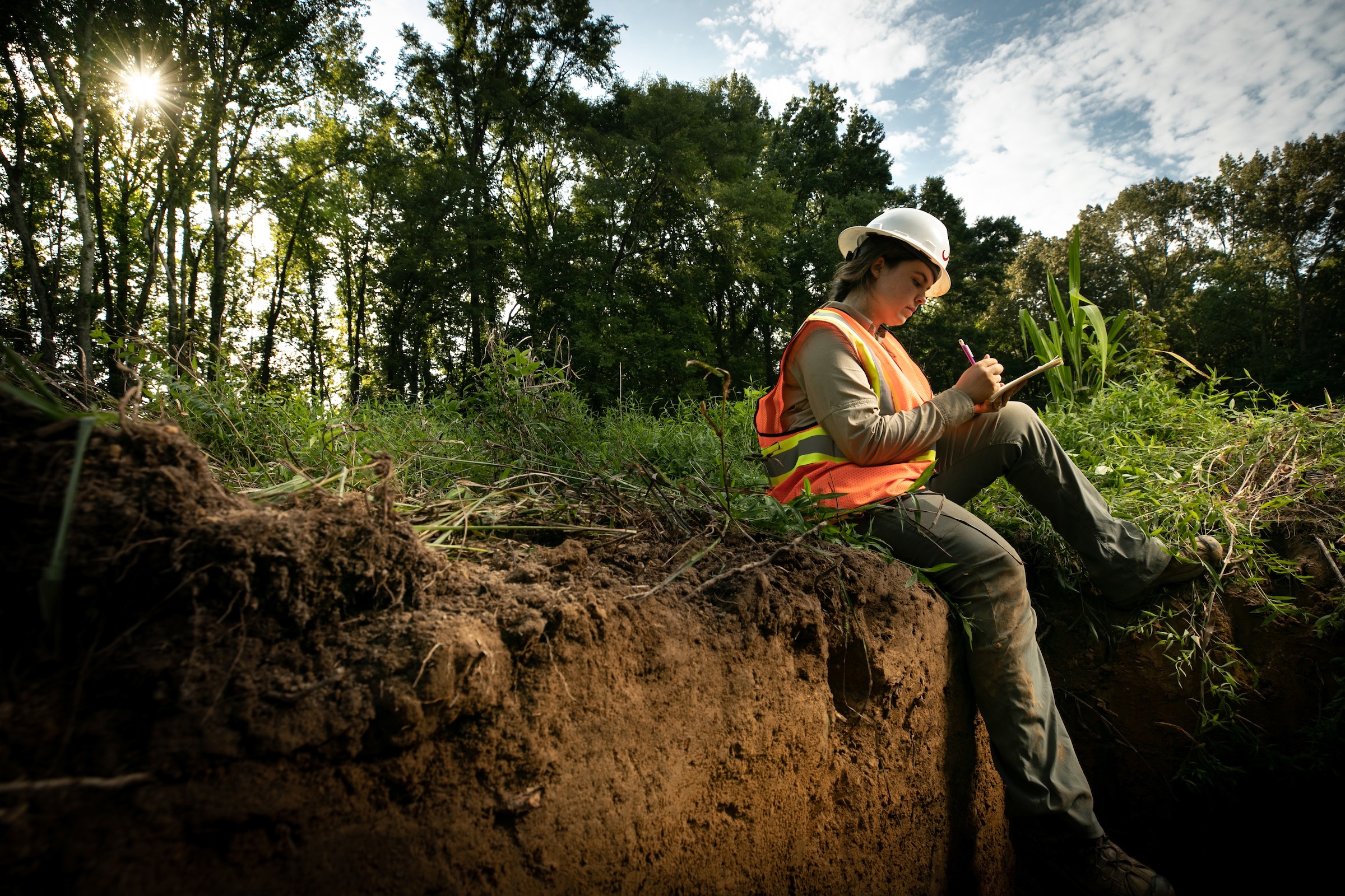
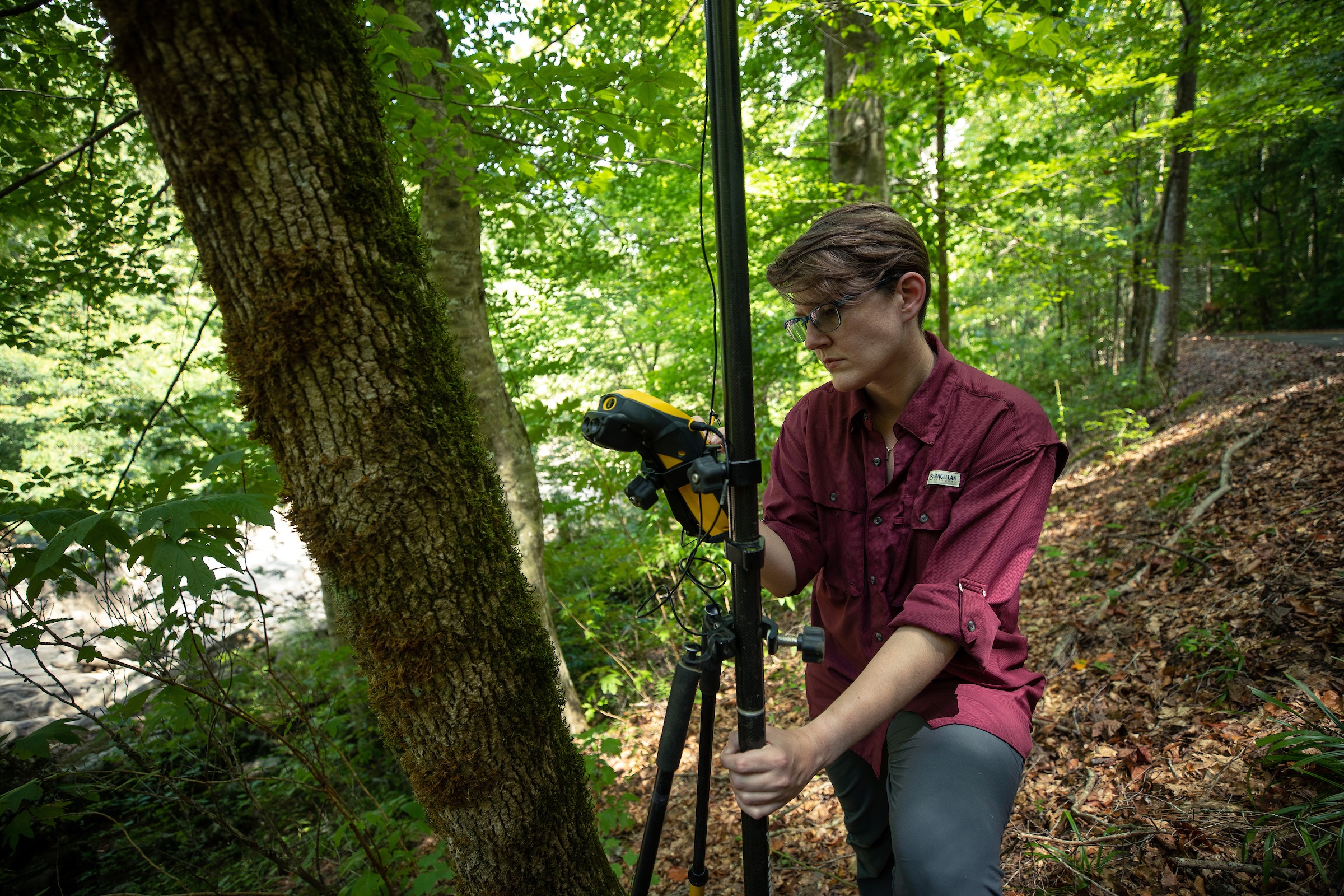
“Our records of floods have several issues, but one of the big problems is our records start when people start using instrumentation,” said Dr. Lisa Davis, a geomorphologist at The University of Alabama. “Calculating the flood of record depends on your record.”
A record’s length and the number of extreme events contained will affect estimates of how often floods occur. That knowledge can be found in records not kept by humans. Etched in trees or buried beneath the ground, these natural records can reveal how the Earth’s systems have behaved over long periods, possibly as far back as 10,000 years.
Davis and her graduate student, Ray Lombardi, found at least three floods in the last 2,300 years along the Tennessee River that were as large as the 1867 flood. They also found three substantially larger than the flood of 1867 that occurred in the last 5,000 years.
“We suspect a lot of the changes in the frequency and magnitude of floods are driven by longer cycles of climate that operate on centennial to millennial timescales, and if your instrument record only goes back 50 to 100 years, which is very typical, it’s very hard to believe that record represents those sorts of processes,” Davis said.
Records of these older floods lead to better understanding of the longer processes of change that affect the timing, size and frequency of floods while allowing for better predictions and preparation of large floods in the future, she said.
Davis is part of a group of researchers called the Collaborative Research on Paleoenvironments and Society, or CoRPS, at the University. They focus on the science of past environmental changes and paleoclimate, or climate information from before recorded history. Several in the group study floods and droughts, events that can disrupt society.
Using innovative methods and leveraging crossdiscipline collaborations, the researchers are providing crucial information to help manage and mitigate the dangers from floods and droughts across the Southeast.
“Instead of designing our water allocation system based on the observed record, we can incorporate the paleo record that gives us a better representation of what’s happening,” said Dr. Glenn Tootle, an environmental engineer at UA.
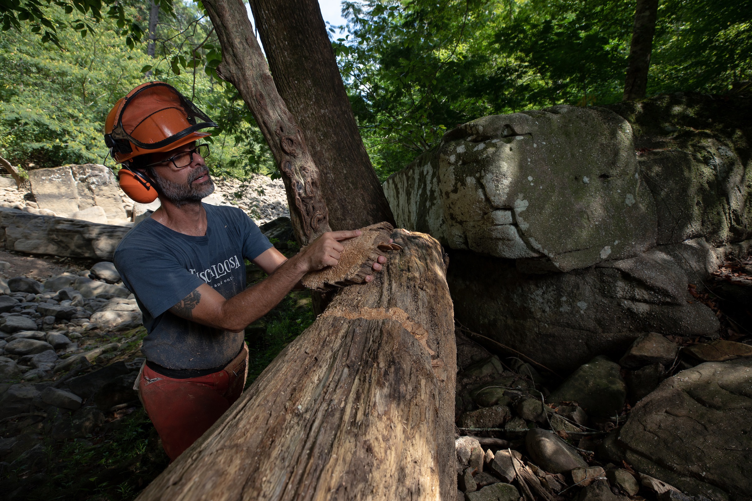
Tootle is involved in a project examining droughts in Alabama and across the Southeast. Using recorded information on how much water flows in a stream, Tootle is working with Dr. Matthew Therrell, a dendrochronologist at UA who examines rings from trees around waterways to determine the frequency and extent of droughts on a long timeline.
“Both floods and droughts are hydroclimatology, and both are informed by paleo proxies,” Therrell said. “We are using natural archives to determine what the range of natural variability in the system is since the instrumental record is so short.”
Their work has already shown a massive decline in streamflow over the past 30 years, and they are putting that in perspective with tree ring records that reach hundreds, sometimes thousands, of years in the past depending on the age of the tree.
Tree rings, which record the annual growth cycle, can tell a lot about environmental change around the tree, and can pinpoint when floods and droughts occur. A wide tree ring indicates the tree took on a lot of water that year, and marks in the ring can indicate floodwaters brought debris that hit the tree. On the other side, a narrow ring means the tree lacked water compared to normal years.
“We know exactly the age of every ring,” Therrell said. “Trees can tell you the exact year and maybe the season of an event.”
Therrell is also working with Davis and others on the paleoflood study along the Tennessee River. The data from tree rings can line up with the instrumental record and verify data Davis and her team get from the soil. The team also draws upon archeology to date artifacts found in the sediment to provide another verification for the time of an event.
“By comparing these different proxies, you get a much better idea of what happened,” Therrell said. “We’re stepping back in time with each different proxy.”
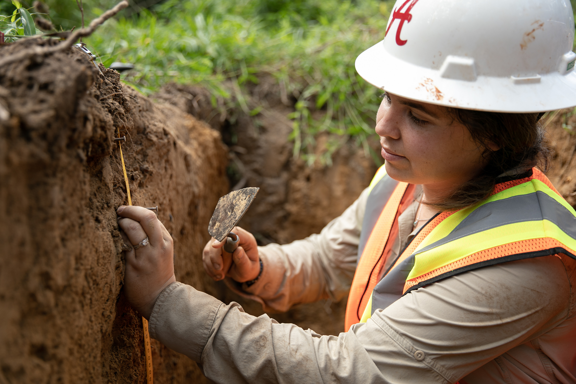
Davis’ project is looking for changes in the sediment, packed like cake layers below the surface. Cores of sediment were pulled from some sites, and, generally, a change to larger sizes of sediment particles and a change in the elemental composition indicates a big flood laid down that layer of sediment, Davis said.

The samples are examined with x-ray fluorescence and dated with radiocarbon and optically stimulated luminescence techniques and compared across sites to develop a robust chronology of past flood activity along the river.
Although tree rings do not do as well as sediment cores at revealing the magnitude of a flood event, the combination with sediment cores reveal both frequency and magnitude of flooding within the system. The information will be used by energy utilities, including the Tennessee Valley Authority, to have a fuller picture of the flood record.
“Managing a working river with nuclear power plants and numerous dams, such as the Tennessee River, means you need to know about the biggest floods possible,” Davis said. “These types of events are underrepresented in streamflow records because of their rarity and the fact they destroy streamflow monitoring instruments when they do occur.”
UA researchers are at the forefront of using paleoenvironmental information to understand how the region’s waterways have behaved through time and even modeling that behavior into the future. Investigators Davis and Therrell, for instance, both serve as advisers to the Nuclear Regulatory Commission and are helping develop guidelines and processes for assessing extreme flood risk.
“In the eastern U.S., our knowledge of long-term climate, long-term streamflow, and long-term flood frequency is limited,” Davis said. “Our methods are opening up new records and new places to investigate.”
Funding for these projects come from the National Science Foundation, Environmental Protection Agency, Mississippi-Alabama Sea Grant Consortium, Electric Power Research Institute, Tennessee Valley Authority and UA.
Dr. Davis is an associate professor of geography, Dr. Therrell is a professor of geography and Dr. Tootle is an associate professor of civil, construction and environmental engineering.